
Itinerary:
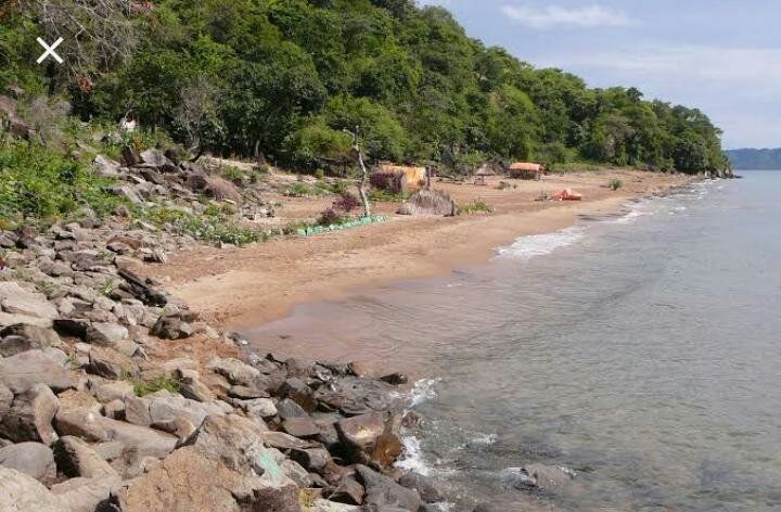
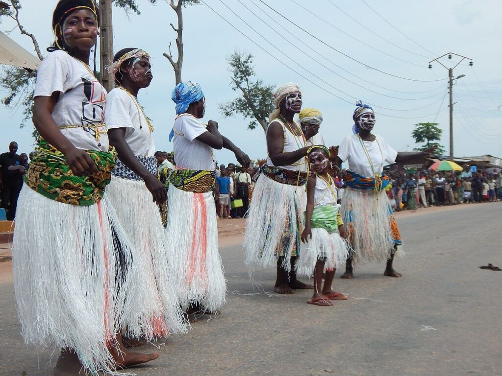
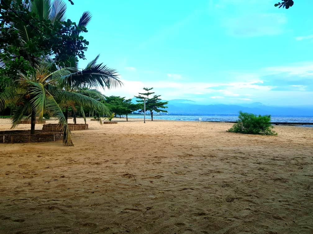
Kalemie is a wonderful hidden gem next to Lake Tanganyika in the east of the Democratic Republic of Congo. For your day tour at Kalemie we will kick off the day by exploring the city by bicycle. We will stop at all the most important sites and make sure you’ll get a good understanding of the city. After a local lunch we’ll head to the shores of Lake Tanganyika where will have the chance to go quad biking on the sandy beaches of Lake Tanganyika near Kalemie.
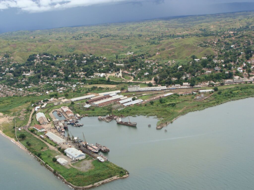
Kalemie
Kalemie, formerly Alberville, is a city in Congo-Kinshasa, provincial capital of Tanganyika Province, split off from the former Katanga Province. Located on the west coast of Lake Tanganyika, it combines an important port for shipping across the lake to Tanzania with a terminal of the Congolese National Railways, the Société Nationale des Chemins de fer du Congo.
The city was founded in 1892 by Belgium under Leopold II in the Congo Free State as a military post in the campaign against Arab merchants, including slave traders. Originally the city was called Albertstad or Albertville, so named by Captain Jacques, after the then Belgian crown prince.
The army post of Albertstad was founded on December 30, 1891 by Captain Jules Jacques, a Belgian soldier in the service of the Congo Free State. It was strategically positioned 15 kilometers south of the Lukuga River. Shortly after its foundation, the military post was attacked by Rumaliza's troops because of the Congo Free State campaign against the Arab-Swahilis. From August 16, 1892 to January 1, 1893, the base was besieged by the Arabs. When they withdrew, Albertstad was abandoned, but the name remained associated with the military post of Mutua, north of the Lukuga. This last base would develop into what is now Kalemie.
In 1914 and 1915 Albertstad served as a base for the Belgian and British troops (led by Geoffrey Spicer-Simson) in the battle for East Africa. During the First World War, in 1915, the railway reached Albertville for the first time. A year later, in 1916, the harbor and the coal mines of Greinerstad were opened. This marked the beginning of a period of economic development, which was further fueled when the FILTISAF textile factory was opened in 1949.
In August 1964, during his operations against the Simba Rebellion, Albertstad was attacked by Major Mike Hoare's mercenaries. In 1971 Albertstad changed its name to Kalemie as a result of Zairization. When Zaire became Congo again in 1996, Kalemie kept its African name.
Lake Tanganyika
Lake Tanganyika is a large lake in Central Africa. Lake Tanganyika is believed to be the second oldest (and second deepest) lake in the world, after Lake Baikal in Siberia. The lake is located within the Western Rift Valley of the Great Rift Valley and is hemmed in by the mountainous walls of the valley. It is the largest rift lake in Africa and the second largest lake in the continent. It is the deepest lake in Africa and contains the second largest amount of fresh (alkaline) water after Lake Baikal. It extends for 673 km in a north-south direction and is on average 50 km wide.
The lake has an area of 32,900 km², a shore with a length of 1,828 km, an average depth of 570 m and a maximum depth of 1,470 m (in the northern basin) and it contains about 18,900 km³ of water. The vast depth and tropical location of the lake prevents "conversion" of water mass, meaning that much of the lower depths of the lake is so-called "fossil water", and is anoxic (that is, it contains no oxygen).
The lake is fed by several streams and rivers during the rainy season, but this feeding is temporary. The main rivers that feed the lake outside the rainy season are the Malagarazi (Tanzania), the Rusizi (Burundi), the Lukuga (Congo) and the Lufubu (Zambia). Of all these rivers, the Malagarazi has the largest catchment area, about 30% of the catchment area of the entire Lake Tanganyika.
The Lukuga is the only river along which the lake drains, this is a tributary of the Congo. This outflow is not always active. Due to its location near the equator, often more water evaporates than is supplied, so that the water level of the lake drops below the level of the outflow. So the lake is semi-Endorheic. Before 12,000 years ago, there was no outflow because there was not enough inflow. The Rusizi, one of the more important current supplies, did not exist then. The water level of Lake Tanganyika was then up to 300 meters lower.
The water level of the lake has been subject to great fluctuations, as can be seen from the deposits on the rocks along the shoreline of the lake. The Rusizi (Burundi) River carries the water from Lake Kivu to Lake Tanganyika, this river water is rich in minerals and sediment which are said to have a direct influence on the chemical condition of the alkaline lake water. The lake is divided between the four surrounding countries: Burundi, Congo-Kinshasa, Tanzania and Zambia, with Congo-Kinshasa (45%) and Tanzania (41%) owning the majority of the lake.
On the western shore are the towns of Uvira, Baraka, Kalemie and Moba, on the eastern shore are Bujumbura and Kigoma (and nearby the historically famous town of Ujiji).
The fish of the lake serve as an important source of protein for the local population. Currently, around 45,000 people are directly involved in fishing. Nearly eight hundred places and around a million people depend on the fishermen. Commercial fishing began in the mid-1950s and has had a profound impact on fish species living in the open water and/or in the depths of the lake. In 1995 the total catch was around 180,000 tons. The former industrial fishery, which boomed in the 1980s, later collapsed. Remarkable is the sport fishing for catfish, tilapia and other large fish species. This form of "sport" is mainly practiced on the lake by (wealthy) expats and magnates.
The lake is also known by aquarists for its diversity of fish species, many of which are often kept in aquariums today. There are many species of cichlids, 98% of which are endemic to the lake. These are fished by the local population with special nets, so that they do not damage the caught fish. These fish can then be exported live to a large number of countries for further trade and breeding as ornamental fish.
The lake was first seen by Europeans in 1858 when explorers Richard Burton and John Hanning Speke were looking for the source of the Nile. Speke then continued the search and found the actual source, Lake Victoria. In 1912-13, the Belgian biologist Louis Stappers was the first to gauge the depth of the lake, arriving at a depth of 1,435 m.
"How would you rate the overall arrangements for the tour 1-5 ( Worst (1) – Best (5) )?"
"Definitely ‘5’."
- Barry and Arunee, Canada and Thailand, Goma City Tour, Virunga Gorilla Trek, and Nyiragongo volcano trek